Our Eroding Watersheds: A Story of Neglect and Loss
If I had to pick one thing that attracted me to Northern Virginia, and specifically Stafford County, it was all of the gorgeous wetlands and waterways. While I'm not sure why, I have always been attracted to water and feel like I have a special relationship with it. When I'm on or near water I feel at peace and I have an innate drive to protect it. According to staff, Stafford County is home to 1,337 acres of regulated tidal wetlands along its coastal waterways, marshes, and riverbanks.[1] Additionally, there are estimates between 8,000 to 12,000 acres of non-tidal palustrine wetlands countywide.[2]
I am beyond thankful that due to the efforts of several residents in the past (mainly between 2004-2008; 18 years ago), the Crow’s Nest Natural Area Preserve now protects over 900 acres of pristine freshwater tidal marshes and contiguous forested wetlands. This includes 23 miles of streams. If you want more information about it's history I highly recommend a book by local author Hal Wiggins titled "A Field Guide to Crow's Nest".
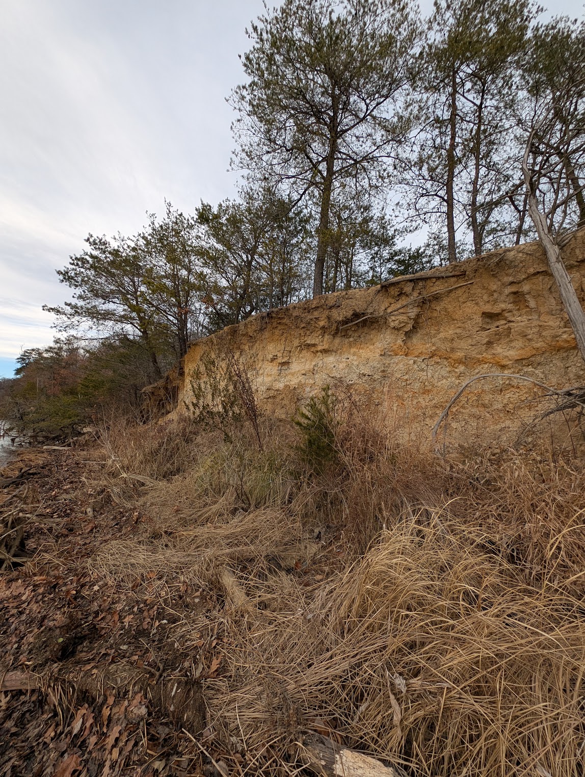
In December of 2025, I started periodically hiking out to Boykin's Landing in Crow's Nest to do quick trash cleanups of all of the stuff that inevitably washes up there. After getting down to the shoreline area and turning around I was presented with an unsettling scene. The peninsula that makes up Crow's Nest Point and Boykin's Landing has been heavily eroding out over time and, if unchecked, the hiking trail will eventually fully collapse into Potomac Creek.
A photo taken illustrating the severity of the erosion at Boykin's Landing. December 12th, 2025
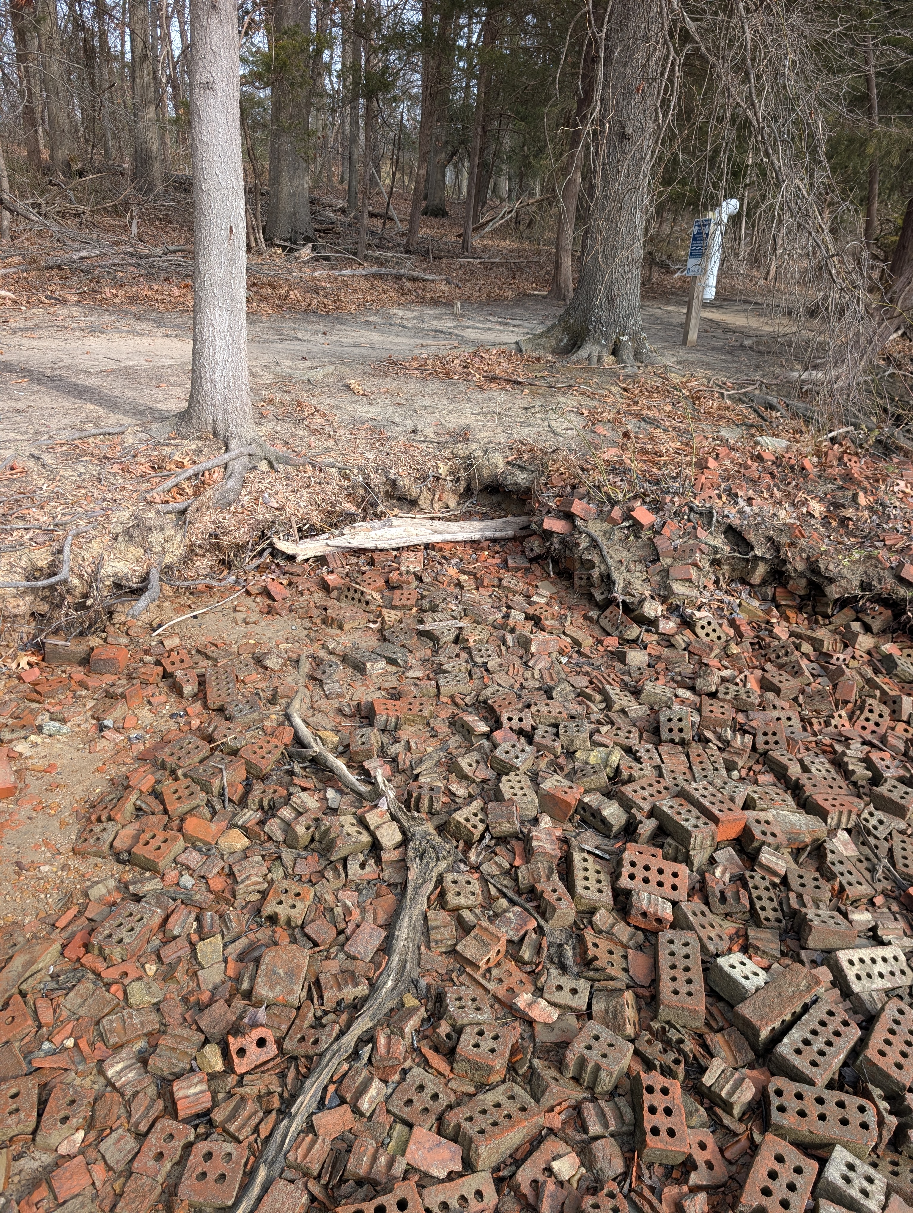
A few weeks later at the beginning of 2026 I noticed similar issues (while at a significantly lesser height) at Widewater State Park, even on the Aquia Creek side. Repurposed bricks were scattered around the shorelines in the past as a means to slow down erosion, but they have not been sufficient to prevent the inevitable. These hiking trails are also at risk of eventually being lost to the daily tidal changes, stormwater runoff, and wakes left by motor boats navigating through the area.
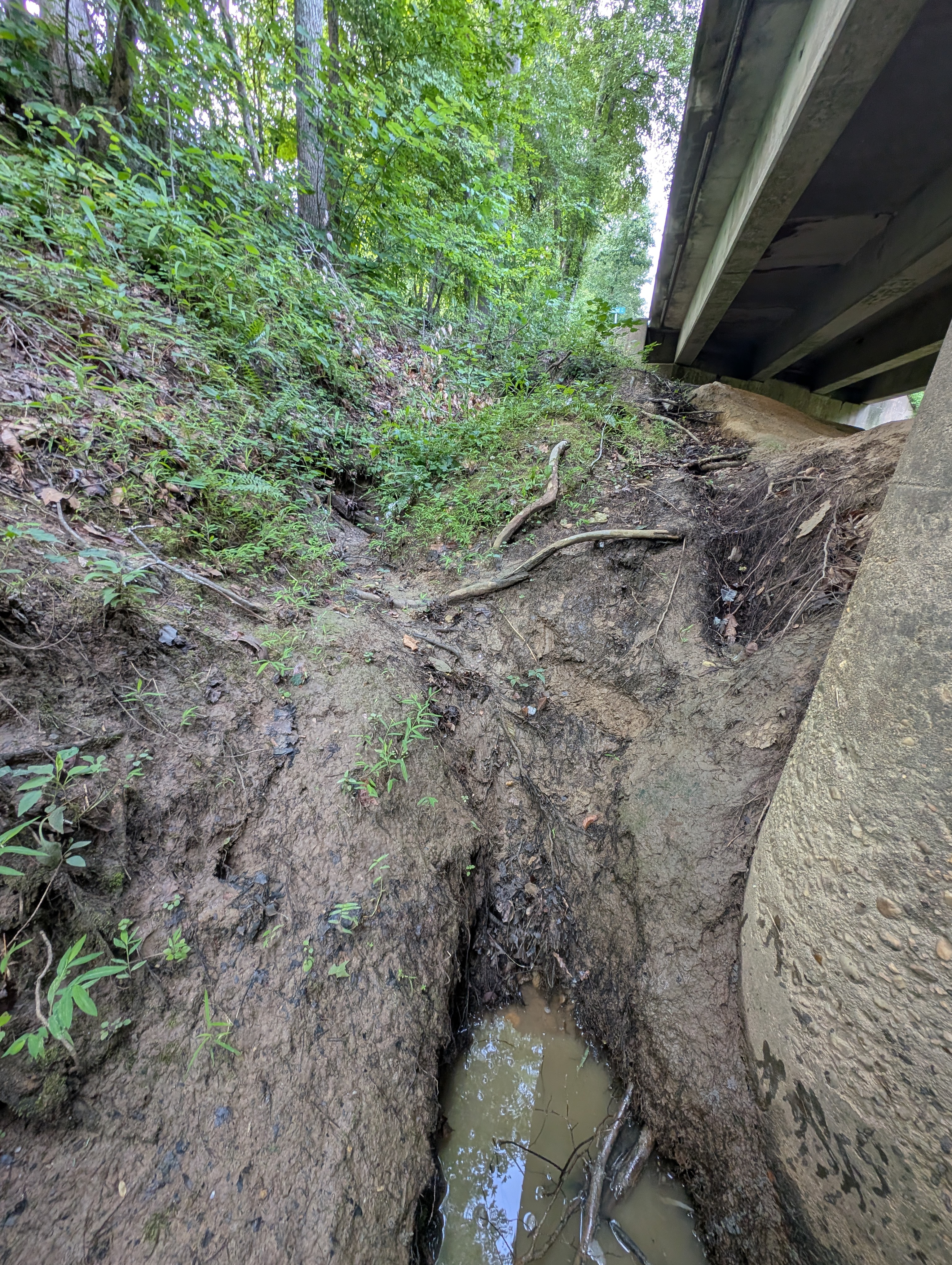
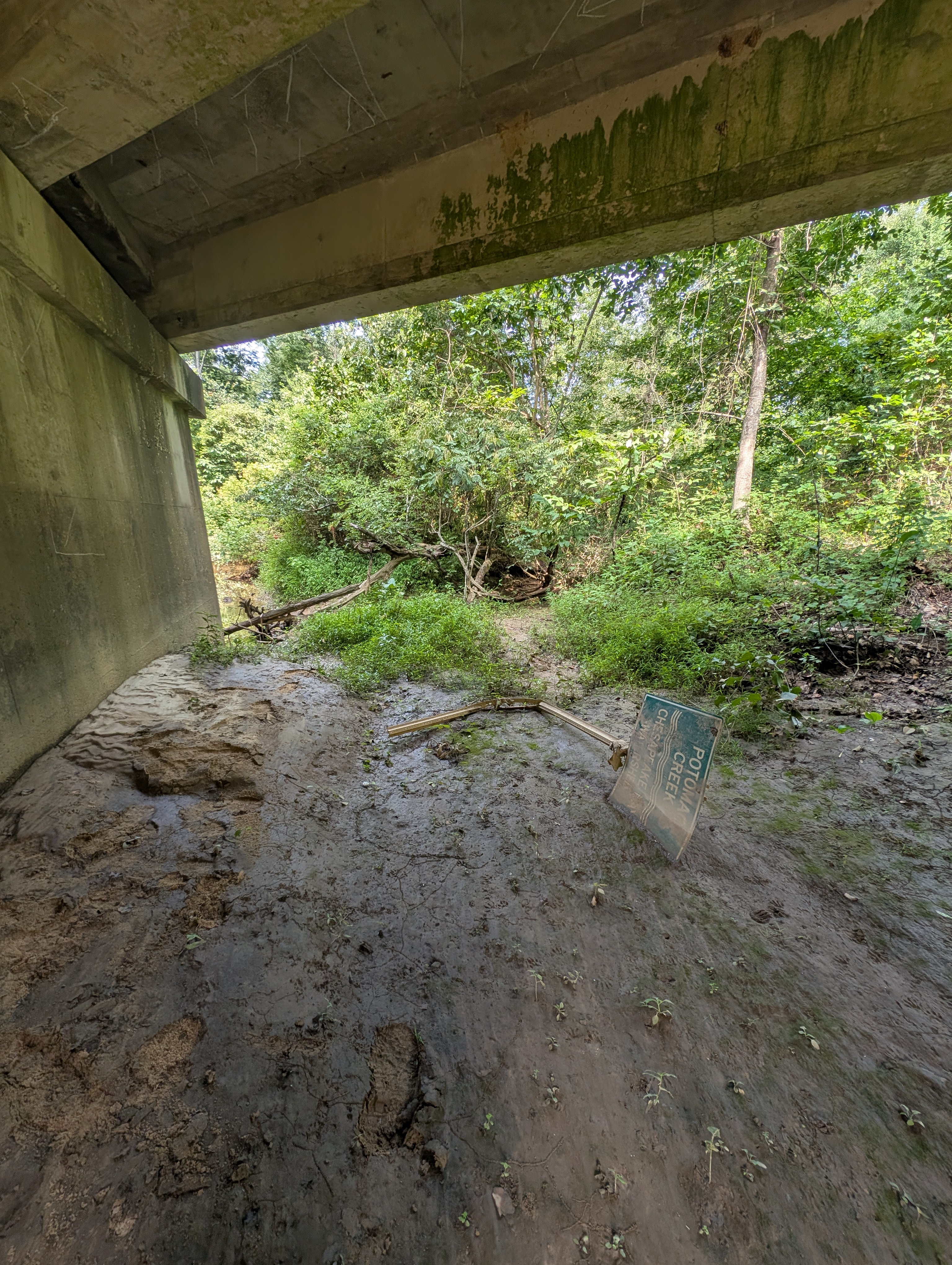
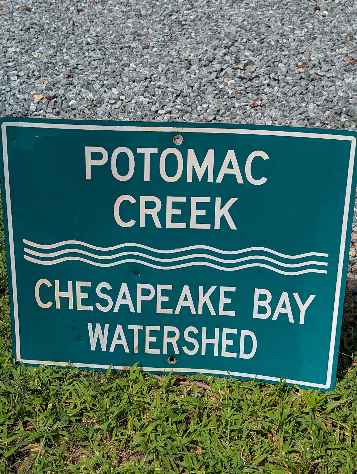
An example of shoreline erosion from the Aquia Creek side of Widewater State Park. You can see the hiking trail very close. January 3rd, 2026A third example is from yesterday's waterway cleanup event where a group of volunteers cleaned up 15 bags out of and away from Potomac Creek and the surrounding marshlands along Potomac Run Road. This is where a number of local residents continuously release significant amounts of litter due to unsecured loads of trash as they transport it to the R-Board Regional Landfill. We chased what seemed to be thousands of styrofoam packing peanuts that eventually got washed down into the creek banks and creek. While cleaning up underneath the overpass I noticed that there are extreme amounts of erosion happening on all 4 slopes leading down to the shoreline of the creek.Heavily eroded channels from stormwater runoff from Potomac Run Road going down to Potomac Creek. August 15th, 2026This leads me to the exact scene that I discovered that inspired me to write this article. Typically when you have a bridge or overpass at a creek or stream there is a sign that informs the passersby what the name of the stream is and what watershed it is a part of. The point of watershed signs at creek overpasses is to educate the public and raise awareness that the surrounding land and roadways connect directly to local water bodies. The hope is that it will have a psychological effect on the brain to trigger the innate human motivators to avoid causing negative impacts in the area. Unfortunately, the erosion is so bad here that it appears that the sign eroded out and was washed underneath the overpass, to become completely neglected and forgotten. This was 1 of 2 signs that were recovered. The other one was a yellow and black striped warning sign to not hit the edge of the overpass. Of course that one was replaced.The abandoned and neglected Potomac Creek Watershed sign that appears to have eroded and washed out and been forgotten.
There are a number of ways to stabilize shorelines in a number of scenarios to restore our riparian buffers. Just to name a few:
Soil Stabilization: Installing stabilization webbing, mats, or logs out of fully biodegradable materials such as coconut husk fibers (coir) staked into the ground along the base of an eroding slope. This stabilizes the soil enough for seeding or planting to occur without it getting completely washed out.[3]
Riparian Buffer Planting: Planting a thick zone of deep rooting native perennial plants, trees, shrubs, and grasses. The thick, interlocking root systems act as a strong structure that binds soil together.[4] You can also do live staking from dormant cuttings of several native species, such as black willow, red twig dogwood, elderberry, and buttonbush.
Living Shorelines: Stacking mesh bags of repurposed oyster shells and/or rock sills just offshore near the low water mark. This structure breaks up the energy of incoming waves and enables native wetlands vegetation, such as marsh grass, to naturally to grow and establish in the calm water behind it.[5]
My main question from all of this: Does anyone care anymore? I've reached out on this matter to Virginia Department of Conservation and Recreation (DCR), the Stafford County Wetlands/Chesapeake Bay/Sand Dunes boards, members on the Stafford County Board of Supervisors, Rangers at Widewater State Park, the Stafford County Agricultural and Land Conservation (ALC) Committee, etc. I'm honestly not sure where to go from here to further the Waterway Cleanups mission of protecting and restoring the waterways of Stafford County. If you have ideas, please drop them in the comments below.
Do you want to walk the path of restoration with me?